
It is difficult to get a grasp of the sea floor structure because of the vast amount of water below the sea surface. In fact, scientists say that it is easier to study the surface of the moon located about 380,000 km away from the Earth than the sea floor, which is only 4.8km in depth on average.
Currently, sound waves are used to study the topography of the sea floor. The speed at which sound waves travel in water is about 1,500m per second, which is relatively fast considering that sound waves travel about 340m in air. Scientists measure the time it takes for sound waves to travel to the seafloor and back to calculate the depth of the sea. For example, if sound waves sent to the sea floor take 4 seconds to return, it could be concluded that it took 2 seconds for each leg of the journey. Therefore, the depth of the sea would be 1,500m x 2 seconds = 3,000m.”
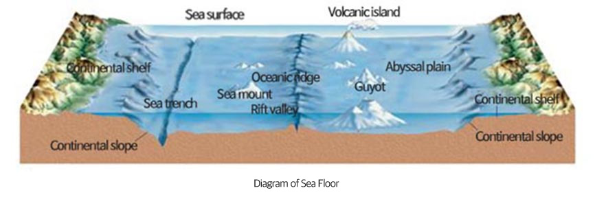
Like land, the structure of the sea floor can include small and large hills, flat plains, deep and long valleys, and large mountains. Furthermore, depending on the structure, the surface can be categorized as a continental shelf, continental slope, continental rise, or abyssal plain. Depending on the depth, they could also be divided into coast, sublittoral, bathyal, or abyssal.
- Continental Shelf: underwater landmass, which extends from land, has a flat slope and an average depth of less than 200m
- Continental slope: a comparatively steep slope from continental shelf to the ocean floor
- Sea Trench: long and narrow valley that stretches 7-10 km with frequent occurrence of earthquakes
- Seamount: submarine volcano rising from the ocean seafloor
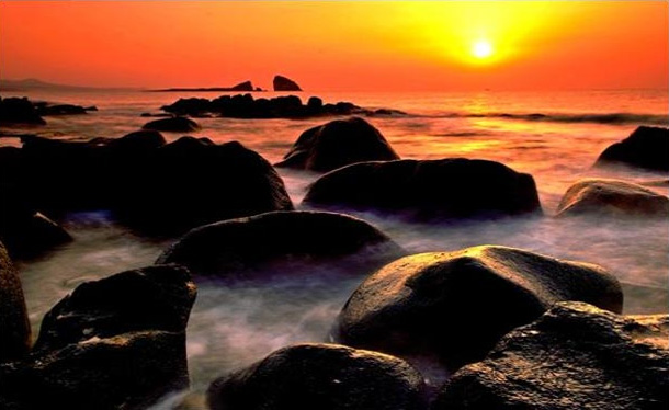
In general, there are four types of coasts. A steep cliff or caves near the plain where the cliff meets the sea water, bays where the shoreline is indented and the current is weak. There are sandy beaches as well as ports where ships can be docked. Lastly, coasts where land protrudes out are called capes which typically have many cliffs and caves.
Coasts that protrude out get eroded by waves and as these deposits pile up, sand stretches out and becomes a beach that people enjoy.
There are three types of coasts: rocky, sandy, and muddy coasts.
Rocky coasts boast splendid scenery. It is common for them to show a sharp rocky precipice. However, when observed more closely, we can see that a totally different phenomenon is taking place. Waves slowly erode away the rock and create arch-shaped reefs and caves.
Sandy coasts are mostly used as a beach. Organisms that live in sandy coasts are completely different from those that live in rocky coasts. While life on rocky coasts attach themselves to rocks, organisms like crabs and shellfish that live on sandy coasts move around and make holes in the sand for coverage. Among them, there are those that live in extremely tight spaces such as between sand grains.
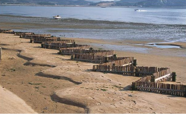
Muddy coasts are a flat sedimentary landform in coasts with large tidal differences, which submerge underwater at high tide and are exposed at ebb tide. Because the tidal range is large and the impact of wave is minimal due to the rugged coastline, the Yellow Sea coast, with large rivers transferring vast amount of sediments, has adequate conditions for mudflat development. Sediments that arrive at the river mouth get delivered towards the sea at ebb tide and particulate residues get transferred back to the coast at high tide, thereby creating mudflats between islands or bays that are calm. Essentially, mudflats are with part of the sea or part of the land twice a day. Mudflats are also very rich in life, containing over 100 million microorganisms per 1cm² .
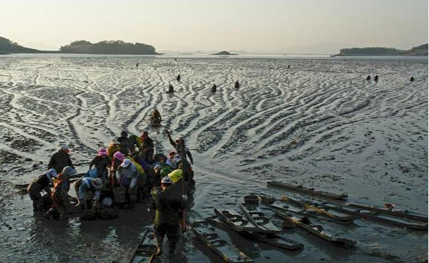
Because mudflats are rich with oxygen and organic matter, there are diverse types of life species. In addition, as fish and shellfish consume food and reproduce there, mudflats are an important home to many living species. Therefore, 90% of economic activities by fishermen directly and indirectly take place here, and in fact, the production output is as large as 3 to 20 times to that of farmlands and oceans. Accordingly, the economic value is so great that mudflats enable fishermen to build their lives economically. Moreover, mudflats are a habitat for fish and shellfish, but also a breeding and resting grounds for migratory birds.
Furthermore, mudflats also purify various contaminants. Organisms living in 1,000 square-meter of a mudflat have the capability of decomposing contaminants equivalent to one city sewage treatment plant. Five hundred lugworms are able to purify 2kg of a person’s feces a day. In addition to such useful functions, mudflats are being used as a recreational space and a place to learn about ecosystems, thereby providing a basis for leisure and education.
Mudflats are replacing land as a place for reclamation projects through seawall construction in addition to fisheries and aquaculture. These are being used as a salt field, farmland, or an industrial complex. In particular, Saemangeum Seawall, which connects Gunsan and Buan, is the longest seawall in the world with a total length of 33.9km. By creating a multi-purpose space for economy, industry, and tourism from 293㎢ of reclamation land and 118㎢ of lake, it completely changed the concept of national land.
Muddy coasts can be categorized into mudflat, sand flat, and gravel flat. However, the most widely-known flat is mudflat, which is mainly created with mud deposits from rivers. When you enter mudflats, your legs will sink deep into the mud. Sand flats are mainly covered in sand and have hard ground. They develop in coasts with fast currents and many dunes. Lastly, gravel flats are formed with deposited gravel and sand from an eroded mountain near the coast.
Mudflats experience a large difference in high tide and ebb tide, and form on coasts that are blocked with bays or islands. Grains of mud, which are small depository particles, sink well in places with weak current and small movements, so mudflats form where water is more or less captivated. In areas where the waves have a greater effect than currents, sand flats are created and the width of the flat also narrows. The conditions for mudflats are as follows: the topography must be gentle, waves need to be weak, and sand and mud need to be sufficiently supplied along the river from land. Furthermore, the difference between high and ebb tides should be large so that floating particles can be accumulated.
Sedimentation refers to the process of a river flowing into the sea during which mud and sand near beaches also flow in and pile up on the sea floor. This is the most important cause of mudflat formation.
Because of high and low tides that circulate, mudflats do not decay. In the case of mudflats, particles that make up the flat are so small that they could decay from insufficient oxygen. However, as fish and shellfish continuously dig holes and eat organisms, it does not get contaminated nor decay.
Mudflats that are made of mud mostly form along the inner coastline, where sea currents are weak, or river mouths, where there aren’t any slopes. Mudflats that resemble clay have smaller distance between deposits so it is difficult for the sea water to penetrate deep into the flat. In these conditions, mudflats are the ideal home to lugworms and crabs that build their homes inside the deposits. The holes they make allow the sea water to flow into the mudflat.
Spring tide is when the tide’s range is at its maximum, and neap tide is when it is at its minimum. When the sun, Earth, and moon are in a straight line on the same side, the tidal force adds up creating a large difference in the high and low tides. Spring tides take place at full moon and old moon.
Neap tides take place when the sun and the moon are at 90 degrees with the Earth at the center. In this position, the tidal force gets dispersed, thereby minimizing the difference between high and low tides. Neap tides take place when the moon is either waxing or waning
- Flowing tide: water flowing into the coast
- Ebb tide: water flowing out to the ocean
- High tide: when the water reaches its highest level
- Low tide: when the water reaches its lowest level
- Tidal difference: the difference in level of water between high and low tides
- Wave interaction: swells that are created as wind waves, which occur on the water surface from wind, weaken as they progress to other coasts are called ocean waves. Ocean waves, as a type of wave, are the waves we see commonly on beaches. The erosion of the coastline by such waves is called wave interaction. It is the mud, sand, and gravel from these erosions that is transferred out to the sea as a result of ebb and flood tide and eventually form mudflats.
Even if there is wave interaction, mudflats cannot form along the eastern coast as there is little difference in the tidal range. On the other hand, mudflats have developed well along the southern and western coasts as a result of the large tidal range. Flats created from wave interaction have large sized gravel. They typically form in the order of gravel, sand, and mud as they get closer to shore
When the sea water is flowing in the same direction, it is called a sea current. Sea currents can be divided into warm currents and cold currents. Warm currents flow from low to high latitude and are high in water temperature and salinity. In addition, because they contain little oxygen and nutrient salt, the water is clear and dark blue. On the other hand, cold currents flow from high to low latitude, and have low temperature and salinity but plenty of oxygen and nutrient. Thus, cold currents are blue-green in color and rich in plankton
In general, although water temperature and salinity are higher, warm currents have little oxygen compared to cold currents and thus, not as many types of fish live there. Most well-known warm current fish species are squid, mackerel, anchovy, and fish tail, and also include sardine, jellyfish, oceanic bonito, bluefin tuna, spearfish shark, yellow tail, blacktip mojarra, Japanese Spanish mackerel, croaker, black porgy, pearl oyster, red drum, banjo fish, yellow grouper, flying fish, red mackerel scad, pacific bonnet mouth, black rock fish, saddled weever, narrow-barred Spanish mackerel, white marlin, blue marlin, and ocellate spot skate.
As for cold current fish species, pollack, cod, herring are well-known, and some other types include sailfin sandfish, pacific sand lance, salmon, coon-striped shrimp, pacific saury, gray mullet, halibut, hair crab, salmon shark, atka mackerel, threaded sculpin, green sturgeon, arctic cod, and elegant sculpin.
※ The texts were written based on the outcome of “Development of Ocean Education Textbook” and “Development of Contents for Ocean Education Textbook” projects conducted by the Korea Maritime Foundation in 2010 and 2011.